Better Algorithms Developed for Offshore Wind Turbulence Measurement
March 12, 2025
Accurate measurements of atmospheric turbulence enable durable and efficient wind turbine design as well as optimized wind farm operation. To advance this, Vaisala participated in a research consortium with global wind energy players to develop better algorithms that improve measurement accuracy of turbulence in offshore weather conditions.
Turbulence can induce loads on wind turbines, and the research project, the POWSEIDOM JIP, led by France Energies Marines, aims to provide the industry with high-performance measurement and modelling tools.
Installing traditional met masts and anemometers offshore is often impractical due to the high costs of installation, operation and maintenance. Lidar technology is cost-effective and reliable, but there has been a need to develop proper algorithms to derive turbulence metrics from the lidar signal, as lidars have not been widely used to characterize atmospheric turbulence at sea in the past.
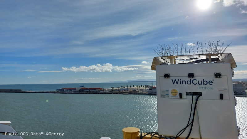
To gather data, the researchers used a Vaisala WindCube v2.1 profiling lidar at the research site at Planier Island. Located 9km offshore, this site allowed them to capture undisturbed atmospheric events that represent the conditions encountered at floating offshore wind farm sites in the Mediterranean. At the end of the first 12 months of the research period, the measurements taken with lidar enabled them to compile a valuable set of data (mean winds and direction, turbulence intensity, shear, occurrence and intensity of low-layer jets).
As a result of this work, the researchers were able to make recommendations for further calculating the turbulence forces induced on turbines.
At sea, lidars are generally deployed on buoys that are in continuous motion. Such motion has to be accurately taken into account to ensure more accurate measurements of wind conditions. For this, the project team also created research setting where a lidar was installed on a mobile platform reproducing the movements of a buoy deployed at sea.
The measurements obtained were compared with those from a fixed lidar, and a preliminary version of a motion compensation algorithm for measuring turbulence was developed. These results were also published in an international peer-reviewed journal called Remote Sensing in April 2024.
Work on the POWSEIDOM JIP is continuing as part of the DRACCAR-NEMO JIP started in 2023.
Project partners are France Energies Marines, Centrale Méditerranée, Shell, Ifremer, Ocean Winds, EDF, Region Sud Province Alpes Côte D’Azur, Polemer Bretagne Atlantique, Polemer Méditerranée and Vaisala.